Research Profile: Complex systems - micro data analysis.
Within the project MARA (Mobility and Accessibility in Rural Areas - New approaches for developing mobility concepts in remote areas), researchers and practitioners will jointly study the needs and challenges that exist in rural tourism destinations.
New solutions and business models will be developed for sustainable mobility, linked to both locals and tourists' needs. The project is an international project with 12 partners from nine countries in the Baltic Sea region.
Within the project, the mobility patterns and needs of locals, businesses and tourists will be mapped. This is done, for example, through mobile data where you can follow daily and seasonal variations in the mobility of people and transport. By developing existing transport solutions and creating and testing new innovative solutions, the project aims to improve the conditions for sustainable transport and infrastructure in tourism-dominated rural
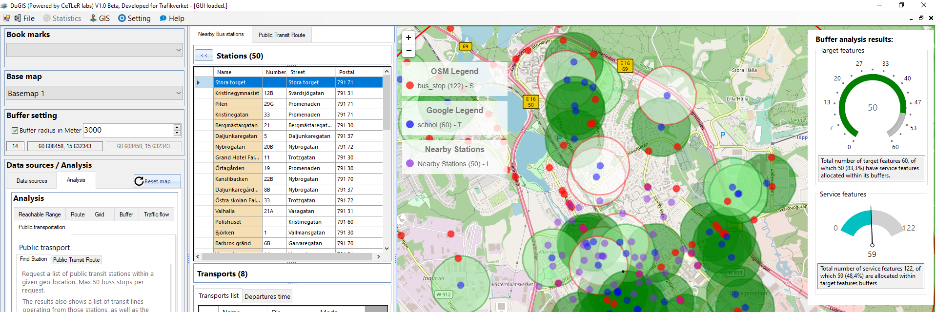
In the Swedish part of the project, researchers from CeTLeR collaborate with community and traffic planners from the Swedish Transport Administration. Part of the project will explore how a model for visualizing existing mobility can be developed, which can present how transports occur, where they occur and to what points. This is done through a dynamic map which makes it possible to see changes over time. The model is created by putting together several different types of data material and visualizing through GIS.
Results:
State of art the GIS tool that integrate several open data sources into single tool and perform multi different special, buffer, grid, reachable and route analysis. Above is a capture screen of the buffering analysis using the developed GIS-Toll.